


Alcaufar and Salgar
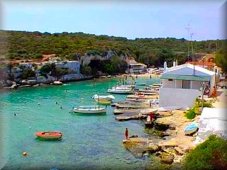
Alcaufar:
It is a small cove next to the hamlet of Alcaufar, where residents, mostly Menorcans, occupy their summer cottages. There is a hotel, not very large, right at the foot of the small beach of fine sand: Hotel Xoroy, the first beach hotel establishment in Menorca.
Cala Alcaufar has underwater currents from the barranco that, being colder, produce strange sensations when one detects sudden changes in temperature while swimming.
Its main attraction is the small houses of the residents and the fishermen's huts on the very coast of Cala Alcaufar, with their slipways that lead like channels or rails to the doorways of the huts where fishermen's boats are sheltered in winter.
At the mouth of Cala Alcaufar there is a defense tower, which can be visited with a short, easy walk, making it suitable for a stroll with the whole family.
Excursions:
There is a defense tower, visible from any point in Alcaufar and even as far as S'Algar. It is another one of those bunker towers built for the defense of the island to prevent landings. With a short walk, we can visit it and see the islets at the entrance of the cove and some caves on the face of the cliff facing the open sea.
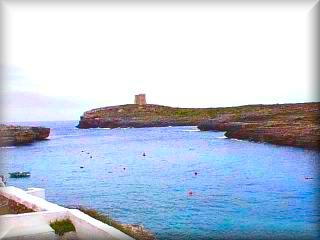
You can also walk along the coast, in the opposite direction to the tower, to reach the nearby S'Algar. This development has an impressive, more or less straight cliff of almost 1 km. With views of La Mola de Maó, the most important military base in Menorca located at the entrance to the Port of Maó, the Tower of Alcaufar, and the lighthouse of the Isla del Aire, opposite the beach of Punta Prima.
S'Algar:
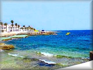 It is a tourist and residential development that grew based on the perseverance and work of one of the greatest promoters of tourism in Menorca, the pioneering entrepreneur Gabino Sintes, who, with tenacity and great vision, carried out most of the development that this veteran urban area has today.
Currently, it is managed under a family regime. The beach is, when the sea has not taken it, a tiny cove—a few meters of sand that the sea swallows at the slightest storm. However, those responsible for the development make sure to enlarge it every year with an artificial sandpit built just behind it, which they fill with sand every year at the beginning of the season and replace if the waves wash it away, which happens at the end of the season year after year.
But there is no shortage of bathing or sunbathing areas in S'Algar. Whether in the pool area by the sea, or near the pier and dry marina, there are wide areas of platforms designed and suitable for tourists and visitors to sunbathe comfortably or swim in the sea, facilitating access with numerous ladders, as if it were a large pool.
The platforms are well-equipped for bathers and have services typical of beaches, service areas, as well as a dock area and a boat yard. It also has a well-established diving club, Salgar Diving Club, which offers diving courses and immersion trips for all ages, with equipment rental available, as well as other recreational aquatic activities, notably parasailing from a powerful boat. The development has a sports complex with a varied offering, hotels and apartment complexes to suit all tastes, catering and entertainment services, as well as a vehicle imitating a train that offers free rides around the development.
Excursion in S'Algar:
It would be unforgivable to be in S'Algar and not take a walk along the cliff, which, due to both its height and its straightness in that section, gives it great beauty and spectacular views. It has a wide sidewalk next to a retaining wall for stormy winter days. Sitting on this wall looking at the Mediterranean sea humbles the soul and provides a sense of peace that fills the mind and body.
If the sea gets very rough, which is very unlikely in summer, there is a "bufador" (blowhole), and the water sprays up, crossing the entire road and the villas, and on more than one occasion, it pulls large stones from the sea and leaves them visible.
We can also take an excursion, walking along the coast from S'Algar to Cala Alcaufar to visit the beach and the defense tower of S'Algar. Bordering the little beach, we can visit the surroundings of the defense tower and appreciate the large caves in the cliff.
Another walk, this one somewhat longer and with a little more difficulty, is to approach Cala Rafalet, about 30 minutes away on foot if walking from S'Algar or from Alcaufar along the Camino de Rafalet. It is recommended to start the path right next to the vehicle parking area in front of the "Las Palmeras" apartment complex, at the end of S'Algar and right where the cliff walk begins. At this spot, there are stone steps over the "dry stone wall" (typical Menorcan walls); we cross to the other side of the wall and take the path.
You can also go by car to the Camino de Rafalet and then walk the last stretch. To do this, we must take the exit road from the development, pass the roundabout, and at the entrance to S'Algar, take the first dirt road on the right for about 800 meters, where we must leave our vehicle.
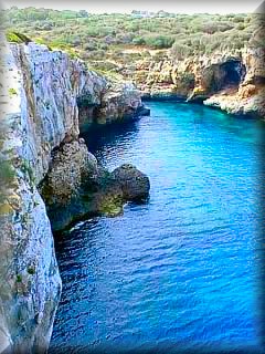
Cala Rafalet:
It is a cove with a tiny beach that does not always retain its sand. As a curiosity, one can observe an image of a face on the side of the cliff, looking out at the sea from the cove itself.
Rarely frequented, it is a very peaceful place to rest, with a lush forest that reaches the water's edge. The cove has a somewhat curved entrance that narrows sharply at the end, and its walls are high; very close by is one of the few eucalyptus forests on the island. This area is very interesting for excursions due to its high cliffs with views of the S'Algar coast, l'Illa de l'Aire opposite Punta Prima, or the military fortress of La Mola at the entrance to the port of Maó.
Access: From the town of Maó, take the M8 passing through Sant Lluís. Upon exiting the roundabout, take the path to the left towards Alcaufar / S'Algar, next to the cemetery, and stay on the road. You will pass two turnoffs on the right that you should ignore. The road ends in Alcaufar, and half a kilometer before it, right at the last curve on the left, is the entrance. We will see the signposted entrance to 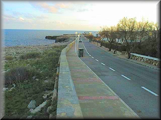 S'Algar and Cala Rafalet.
There is only 1 km left to S'Algar.
For Alcaufar, we continue along the path instead of entering S'Algar, as it ends in Alcaufar. Be attentive, because only 600 meters later, next to a hermitage, we will see a sign indicating the path down to the beach and Hotel Xoroy. There are only 200 meters left; the parking lot is on the right behind the hotel.
If we pass it, we will go to the more commercial area of Alcaufar and can return via the main street of the town.
For Cala Rafalet, it is best to enter S'Algar. Just upon reaching the development, there is a roundabout; go all the way around and return along the same S'Algar road. Two hundred meters later, on the right, there is a dirt road. Take it, and in less than 1 km, we must leave the car.
Near the cove, right up to where some chains block the way, we must walk 5 minutes along a path that runs through the forest.
Another possibility is to enter the S'Algar development and consult the travel map or ask for help to cross to the end of the development to leave the car in the area of the Las Palmeras Apartments; just behind it is a path that leads to Cala Rafalet.
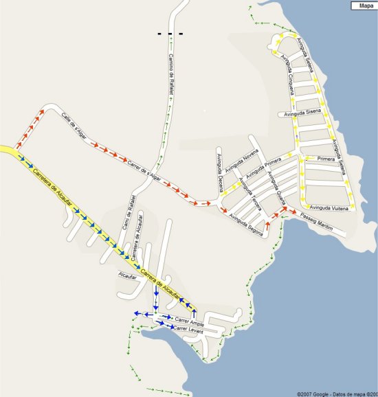
Map of S'Algar and Cala Alcaufar.
The line of blue arrows, the Alcaufar road, leads to the town, the beach, and the Hotel Xoroy.
The line of red arrows indicates the path that leads to the S'Algar development, Hotel San Luis, Las Palmeras Apartments, Los Naranjos Apartments, Vistafaro Apartments, Rafalet Apartments, and the Hotel S'Algar.
Direct access to the Map of Alcaufar and the S'Algar development
The points and routes described below are indicated on the map shown by clicking on the one on screen.
1 - ) Cala Alcaufar road.
2 - ) Road fork: straight for Cala Alcaufar, left for the S'Algar residential area.
3 - ) Roundabout right at the entrance to the S'Algar (Salgar) residential area: left directly to Hotel San Luis, straight to the cliff area and the tourist chalet and private villa area, right to Hotel S'Algar, the diving center, the pier, and the shopping center (see footnote).
4 - ) Parking next to the Diving Center and the side of Hotel Salgar; in summer, the road ends here, you must walk to reach the shopping center.
5 - ) Hotel San Luis, next to the sports area of the S'Algar residential area.
6 - ) Hotel S'Algar, 50 meters from the sea, next to the coast; it has a restaurant with a pool on the coast itself, and where diving students perform their practice dives.
7 - ) Parking in front of the "Las Palmeras" tourist apartment complex and one of the access points to the footpath to walk to Cala Rafalet.
8 - ) Just past point 7 and up to point 9, along about 800 meters of cliff, the view is spectacular.
9 - ) The street route along the cliff has opposite traffic directions throughout; the itinerary you should follow to tour the entire residential area is marked in yellow.
10 - ) Oldest area of the S'Algar residential area, known as "El Pueblo"; it is the shopping center facing the S'Algar Pier and Dry Marina. Salgar does not have a beach, but large platforms allow for sunbathing and swimming.
11 - ) "Vista Faro" apartments. If staying here, access is via the road leading to point 9, from the cliff and the apartments. Of course, if you look south, you can see the lighthouse of the Isla del Aire, facing the beach and the tourist residential area of Punta Prima.
12 - ) Rafalet apartments.
13 - ) "Los Naranjos" apartments.
14 - ) Parking area in front of Hotel San Luis and next to the Salgar sports area.
15 - ) Right at the end of the Hotel S'Algar pool area and the scuba diving center, the coastal path begins, leading to the town of Cala Alcaufar in about a 15-minute walk.
16 - ) Cala Rafalet. The excursion to this tiny cove is curious due to the path through the shady forest at the bottom of the Rafalet barranco. It is recommended to take the path that climbs to the north side of the barranco and admire the S'Algar cliff from the front.
17 - ) Road that leads to Cala Rafaelet by car, but at about 6 meters it is blocked by chains, and you must continue on foot to the small and curious Cala Rafaelet.
18 - ) Descent point to Alcaufar beach; right at this point is the "Ermita de Alcaufar".
19 - ) At this point, you can go to a vehicle parking area on the right and go down to the beach, or continue the excursion to the Alcaufar tower, crossing the bridge that spans the Alcaufar barranco right above the beach.
20 - ) Alcaufar beach, somewhat small but suitable for swimming and sunbathing; it has all services, and Hotel Xoroy is right next to the beach itself.
21 - ) Central area, main entrance and exit of the town, taxi and bus stop for Alcaufar.
ROUTE:
Roads, car circuits.
The points indicated with BLUE arrow lines represent the access route to Cala Alcaufar.
The points indicated with RED arrow lines represent the access route to the Salgar residential area.
Footpaths, itineraries, walking routes.
There are three recommended excursion sites, marked by green arrow lines.
I) To the Alcaufar tower, starting from Alcaufar beach.
II) To Cala Rafaelet, two paths: via the Rafaelet path or via the footpath next to the Las Palmeras apartments (point 7) at the end of the Salgar residential area.
III) Coastal circuit connecting Alcaufar and Salgar or vice versa.
22 - ) Panoramic point: view of the entire Cala Alcaufar and the defense tower on the other shore of the Cala Alcaufar.
23 - ) Behind Alcaufar beach, and crossing the barranco that flows into the beach, there is a bridge closed to vehicles. Since the planned residential area with a golf course is suspended, the pedestrian crossing allows access to visit the recently restored Alcaufar tower or take the path to Binibeca beach.
24 - ) Path separation point: to the left to the Alcaufar tower, straight ahead we can walk to Binibeca beach and one kilometer further to Binibeca Vell, about a thirty (30) minute walk.
25 - ) Location where the Alcaufar tower is situated on the coast, from which you get an unbeatable view of the town of Alcaufar and the entire stretch of the coast, both towards Binibeca and towards S'Algar.
NOTES:
To tour the S'Algar residential area, take note of the itineraries marked with yellow arrows on the map; these are the directions for the main streets, and where you must drive if you wish to see all the points of interest in Salgar, especially to fully appreciate the S'Algar cliff.
Views, when they are satellite photographs, are generally oriented so that the coastline is longitudinal to the screen, or so that they show the maximum number of points to guide the visitor; therefore, they do not always coincide with the standard orientation for maps, which is north at the top.
Copyright Islademenorca.es, total or partial reproduction prohibited of
the documents and photos published on this portal.
Photographs: Omar Mauro Banquero